What Happens After the Worst Happens?

Frank Gohlke, Rockfall inside Mount St. Helens crater. 1990.
“I am most touched by those places where damage and grace are inextricably entangled.”
Was it the beginning of time or the end? As he peered through the ground glass of his Linholf camera, Frank Gohlke would have been hardpressed to discern the difference. It was summer 1981. A helicopter had dropped the photographer and two companions from the U.S. Forest Service into the crater of Mount St. Helens. A year earlier, the volcano had erupted in a huge explosion that blew 1,300 feet off its near-perfect cone. The top of the mountain, once known as the Fujiyama of North America for the exquisite symmetry of its form, now lay strewn in massive chunks in the valley far below. In its place was a cracked and gaping crater, one mile wide and 2,000 feet deep.
“The blast had turned back the evolutionary clock to something that resembled the caustic beginnings of life on earth.”
The three men stood ankle deep in ash in what had been the very heart of the eruption. Even now, the place remained dangerously restive. Tremors regularly shook the rock, dislodging boulders that kicked up great rooster tails of dust as they bounced off the crater’s walls. Snowfall blanketed the ground, insulated by deep layers of putty-gray ash. Steam seeped up from the volcano’s fumaroles, gnawing at the underside of the snowpack, riddling the frozen crust with caverns and crevasses that made each step treacherously uncertain. Even the waters around the mountain were hazardous. Gone were the clear-running streams and cold-water lakes. Gone were frogs, salamanders, and trout. The blast had turned back the evolutionary clock to something that resembled the caustic beginnings of life on earth. Indeed, if you had dipped a jar into those waters and magnified its contents, you would have seen a snow globe of floating single-celled organisms, some of them noxious like the Legionella bacterium that already had sickened scientists with respiratory ailments.
This wasn’t Gohlke’s first up-close look at disaster. In 1979, whole swaths of his home town of Wichita Falls, Texas, were leveled by a tornado. He packed up his camera and drove back to his childhood streets to document the twister’s aftermath. Some of the photographs he took there were eerily prescient of scenes he would later encounter at Mount St. Helens. In one picture, spears of splintered lumber lie scattered in the open field of the local Kiwanis park. They all point in one direction, delineating the path of the wind that had ripped post from beam in the wood framing of houses and then spit them out into the park.
The Texas photographs were wrenching meditations on the fragility of ordinary human lives crushed by indifferent natural forces. Still, nothing prepared Gohlke for the scale of devastation at Mount St. Helens. Between 1981 and 1990, he visited the volcano five times. People often asked him, “What’s it like out there?” The artist, renowned not only for his carefully constructed photographs but also for the meticulous craftsmanship of his language, simply replied, it’s big. “That was the only thing I could say. It’s big, it’s really big, in every way,” he later told me. [2]

Frank Gohlke, View of Mount St. Helens crater from Independence Pass. Approximately ten miles northeast of Mount St. Helens. 1981.
And it was big. Most people associate the eruption of Mount St. Helens with the scene that made the front page of newspapers around the globe: a fifteen-mile-high column of black, cauliflower-shaped ash, pumice, and gases that roiled for nine hours out of the shattered peak of the mountain. In reality, the eruption was a five-punch knockout, one catastrophic event after another that ended with the iconic smokestack discharge.
“In reality, the eruption was a five-punch knockout, one catastrophic event after another.”
It all began in early spring 1980 with a series of earthquakes and sporadic jets of steam and ash indicating that magma was on the move under the volcano. On its north face, the magma began to nose up against a barrier of brittle rock, which bulged outward under the pressure, growing by as much as five ominous feet per day. Then at 8:32 a.m. on May 18, on an otherwise calm, sunny Sunday morning, a 5.1 magnitude earthquake broke the tension and caused the upper north flank of the mountain to collapse in a series of massive landslides. Great avalanches of ice, rock, trees, and earth hurtled into the Toutle River valley below, storming through fourteen miles of rugged terrain in a mere ten minutes, burying some places to depths of 640 feet.
Some of this hash plowed into Spirit Lake, a secluded mountain getaway that once hosted scout camps, summer cottages, and small resorts. The force of the cascading debris created a tsunami that sent water coursing some 850 feet up and over the surrounding slopes. As the wave receded, it ripped old-growth forests of giant hemlock and Douglas fir from their moorings and sucked them into the lake. The debris would raise the lake bed by more than 200 feet and cause its surface area to double in size.
But this was just the beginning. The collapse of the mountain’s north face uncorked pressurized groundwater, unleashing a hurricane-force wind of searing gas and fractured rock that exploded sideways out of the mountain. Although it flowed like a liquid along the contours of the land, its effect was described to Gohlke as a “superheated brick wall moving at highway speed.” [3] As the blast cloud advanced, it pulverized trees along the way, incorporating woody shards into a blender-like force that quickly overtook the landslides. Reaching temperatures of 550 °F, it flattened the nearby forests and scorched others up to seventeen miles away.
Then, over the next several hours, eighteen pyroclastic flows of hot gases, ash, and pumice spilled out of the mountain. Reaching temperatures of 1,500 °F, these flows sterilized a six-square-mile basin north of the volcano. Portions of the basin, later named the Pumice Plain, were so hot that they remained hazardous to scientists for three years.

Frank Gohlke, Aerial view: landslide-debris-flow area, looking east towards Spirit Lake. Five miles north of Mount St. Helens. 1982.
The heat of the blast melted some of the snow and ice on the mountain’s eleven glaciers, and an estimated 47 billion gallons of water mixed with 1.4 billion cubic yards of ash and rocks to form massive mudflows known as lahars. These slurries rampaged down the Toutle River valley, uprooting trees and rafting houses and bridges from their foundations. Sediments and debris were carried as far as the Columbia River, 70 miles away. Indeed, for several days after the eruption, the U.S. Army Corps of Engineers was forced to close the Columbia’s channel to commercial navigation while it dredged sludge out of the river bed.
Last but not least, the mountain coughed up fragments of rock, lava, and ash known as tephra, which blanketed the region. Up to several feet of tephra fell in the crater. When moistened by rain, it took on the consistency of wet cement.
“Gohlke had ‘already been thinking hard about the scale of human habitation, the permanence or the impermanence of the things we do.’”
Primed by his experiences in Wichita Falls, Gohlke arrived at Mount St. Helens in summer 1981 already contemplating our species’ fragile tenancy on the planet. His explorations of the volcano only deepened these reflections. “I had already been thinking hard about the scale of human habitation … the permanence or the impermanence of the things we do, and the ability of natural forces to just obliterate it all in an instant,” he recalled. “The more I thought about that, the more I realized that you could look at the whole of human history in terms of these kinds of cataclysms that destroyed civilizations and made places habitable or uninhabitable, and at one point came pretty close to extinguishing the human line. That was pretty heady stuff. Mount St. Helens was just making the same statements to us as human beings.” [4]
For the first time in history, however, the power to bring an end to the human line belonged to people as well as to nature. Gohlke’s forays into the field coincided with the Reagan years, when nuclear annihilation was on everybody’s mind. “Even after the first START Treaty was passed, the situation hadn’t fundamentally changed,” he said. “The United States and the Soviet Union were still facing one another with arsenals that could destroy the whole planet many, many times over. Looking at Mount St. Helens was in some ways looking into a possible future, but not one that was due to natural causes but one that we [could bring on] ourselves.” [5]
His photographs of the scorched and pummeled land could easily have been a preview of a nuclear winter scenario. Navigating this terrain proved challenging in the early years. The eruption had terraformed roads and washed out bridges, restricting ground access to the blast zone. “When you’re clambering around through one of those blowdowns, it’s not like you’re stepping through the trees,” Gohlke recalled. “You’re climbing up onto big tree trunks, walking up as far as you can. If you’re lucky there’s another trunk. Often you just had to get down and climb back up. It’s a slow way to travel.” [6] So he took to the sky, hiring helicopters to drop him into the crater or fixed-wing airplanes whose pilots allowed him to remove windows and even the doors so that he could lean his camera out into the open air as they circled the blast zone.

Frank Gohlke, Goldwater Creek seeks a new course. Northern edge of landslide-debris flow, six miles northwest of Mount St. Helens. 1981.
From this elevation, Gohlke was able to frame a bigger view of the volcano’s handiwork. Fragments of the mountaintop, some as big as a house, had come to rest miles away on valley floors. Soils and rock from the volcano’s midsection had slumped down its slopes, burying the surrounding rivers and the woodlands that grew along their banks, leaving a denuded landscape pockmarked with depressions of foul-smelling water. Ridge after ridge bristled with the downed matchsticks of trees. Clotting the surface of Spirit Lake, the clear alpine eye that once reflected the brilliant white mantle of Mount St. Helens’s snow-covered peak, was a mat of toppled trees. Many were the mossy Methuselahs of the old-growth forest that had grown on its shores. They had stretched to several hundred feet tall and nearly seven feet in diameter before they were whisked like pick-up sticks into the water. But perhaps nothing made the land seem more lifeless than the topdressing of ash, which smothered the contours of stricken elk, rocks, and tangled trees. Biologist John Edwards, who visited the site just weeks after the eruption, described its effect like this: “The sky was overcast, gray, and everywhere you looked was gray. It felt like your color vision had been turned off.” [7]
“A topdressing of ash smothered the contours of stricken elk, rocks, and tangled trees. ‘It felt like your color vision had been turned off.’”
When the Museum of Modern Art exhibited a selection of Gohlke’s images in 2005, both curators and critics focused on this magnificent mess. In a review for The New York Times, Ken Johnson wrote, “the effects of a destructive force of unimaginable proportions calls to mind the 18th-century idea of the sublime: the frightening and exhilarating confrontation with an unfathomably vast and powerful universe in which human life seems but a minor and fragile accident.” A more precise description for Mount St. Helens’s blend of terror and exhilaration might be the apocalyptic sublime, a term used by art historian Morton D. Paley to describe a genre of 18th-century artworks that feature cataclysmic scenes from the Old Testament and Book of Revelation. [8] Photographers like David Maisel have since picked up the concept and applied it to landscapes strafed by industrial-scale exploitation, such as open-pit mines. [9]
Yet the conditions of apocalyptic sublime at Mount St. Helens were fundamentally different. For starters, the mountain was a natural agent of disturbance, one bead among many in a necklace of volcanos, from California to British Columbia, whose eruptions have shaped the essential character, economy, and ecology of the land. Over 30 million years, the region’s species evolved strategies to cope with such onslaughts and eventually to thrive.
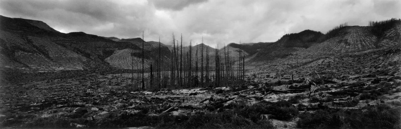
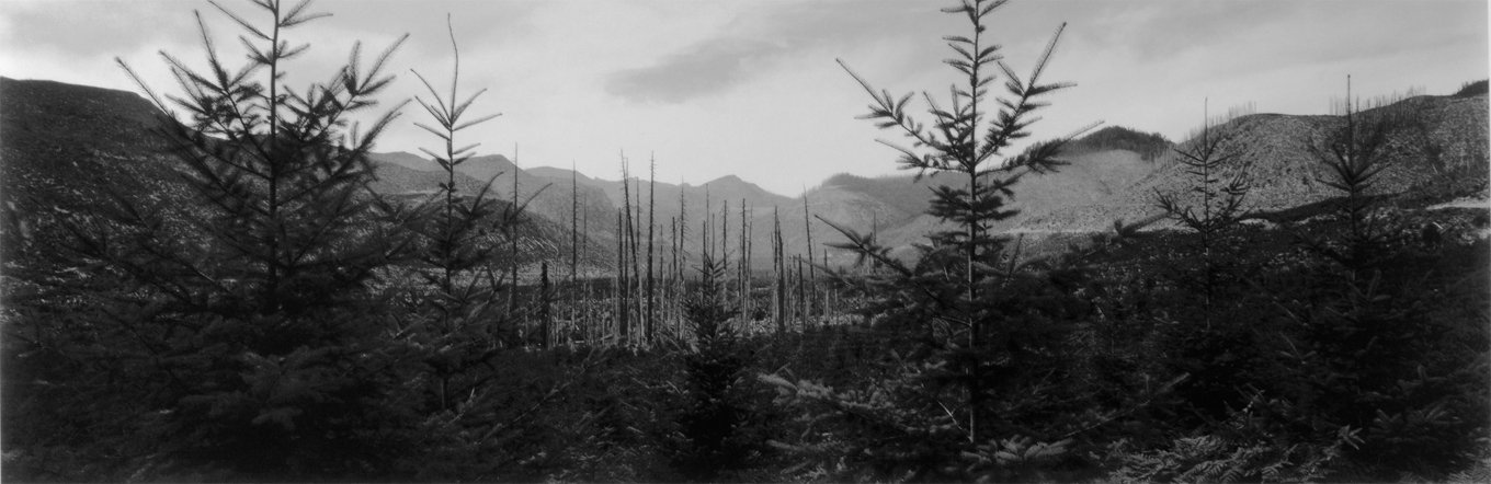
Frank Gohlke, Timber salvage in valley of Clearwater Creek. Thirteen miles northeast of Mount St. Helens. 1983.
Indeed, by the time of the 2005 exhibition, the landscape had changed dramatically since Gohlke first landed in the crater. And scientists had long been on the scene, painstakingly documenting a creative force that was, in its own way, just as powerful and interesting as the eruption. We see a glimpse of that regenerative force in a pair of exquisite photos that Gohlke took five years apart in the Coldwater Creek valley, some 13 miles northeast of the crater. In the center of both pictures is a thin line of standing trees seared by the heat of the blast. Loggers removed salvageable wood from the immediate area, but left these scorched stragglers behind. In the 1985 image, the trees stand forlorn in a large clearing, but in the sequel, five years later, the foreground is etched with a tracery of branches from young conifers that took root in the intervening years.
“As one critic observed, the exhibition raised questions ‘about the limitations of fine-art photography as a witness to natural history.’”
Ecologists refer to remnant features like dead snags as lifeboat structures since they serve as critical havens for plant and animal survivors following a disturbance. As Gohlke wrote in the exhibition monograph, the burned trees provided shelter for “the descendants of the many creatures displaced by the salvage operation. Animals of all sizes would sleep, hide, mate, and hunt among the trunks; birds would nest, fledge their young, dig for insects, and perch in the branches singing; spiders would spin; insects would burrow, eat, hatch, metamorphose, crawl; fungi would work their way from bottom to top, outside-in, inside-out, digesting all the way; bacteria would perform the humble tasks on which all else depends.” [10]
The land’s extraordinary capacity for a lifesome response, however, was largely eclipsed by the sheer number of pictures depicting the volcano’s destructive power. As a result, references to the subtler regenerative forces of nature were largely overlooked. As Johnson observed in his New York Times review, “The exhibition is compelling for the story it tells in words and pictures about the effects of a major volcanic eruption. But it is also at least as interesting for the questions it raises about the limitations of fine-art photography as a witness to natural history.” [11]
Frank Gohlke, Valley of Clearwater Creek. Thirteen miles northeast of mount St. Helens. 1990.
I would argue that the fault lies not simply with the curation of Gohlke’s storytelling but in our own human tuning to disaster. Evolutionary psychologists tell us that our antennae are highly sensitive to danger, because our survival as a species has depended upon intercepting signals of environmental threat and responding immediately. And no one knew the destructive potential of the volcano better than the native people living in its shadow. Mount St. Helens is the youngest and most active volcano in the Cascade Range, built to its pre-1980 height only four centuries ago, and there was another major eruption as recently as 1857. The region’s tribes braided the mountain’s allure and terror into topographic names and legends. In one story, the snow-clad peak is a beautiful maiden, Loowit, who is the object of violent struggles between two contesting lovers. Another name for the volcano is Louwala-Clough, or Smoking Mountain.
“Stories in nature are once-upon-a-time stories, with slow, winding plots and surprise twists that evolve in the telling and are never finished.”
“Landscapes tell stories, if we know how to listen,” wrote Charles Goodrich, Kathleen Dean Moore, and Frederick J. Swanson, in their introduction to the edited collection In the Blast Zone: Catastrophe and Renewal on Mount St. Helens. After the 1980 eruption, “the story most people heard seemed to be almost entirely about violence, danger, and devastation. But even as rescue efforts continued for the people missing on the mountain, scientists went up to the volcano looking for other stories. They wanted to see how the landscape would respond to these enormous disturbances, and they brought along some reasonable hypotheses. But much of what they saw and learned was so radically different from what they expected that their new findings have significantly changed several branches of ecology.” [12]
Stories in nature are once-upon-a-time stories, with slow, winding plots and surprise twists that evolve in the telling and are never finished. Once upon a time, Mount St. Helens came as close as a mountain can get to earthly perfection. And then the worst happened. But the land never stopped telling its stories. Fortunately, there were people on the ground who knew how to listen, who could make sense of what they heard, who pondered its implications and understood that they were entrusted with knowledge of the most miraculous kind. They’ve been writing the sequel to the eruption for nearly four decades now and counting — trying to answer that crucial question, What happens after the worst happens?

Frank Gohlke, Forest Service naturalist approaching Mount St. Helens from the north, one mile and 4,00 vertical feet from the crater. 1990.
For all the attention from scientists, however, the post-eruption landscape has not attracted commensurate interest from fine-art photographers. Even Gohlke did not return to the mountain to investigate the land’s resurgence after his last trip in 1990. It must have been hard to imagine that the sequel could be as compelling as being on the ground in the immediate aftermath of the eruption. The apocalyptic sublime can prompt such a deep reordering of one’s relationship to the universe that it can take years, maybe even a lifetime, to assimilate. That certainly seems to have been true for Gohlke. Nearly four decades later, he is in a sense still walking the volcano, sorting through a debris of bedrock questions. “It was hard to move on from Mount St. Helens,” he confessed. “I’m not sure I ever have really. A friend of mine once told me, when you describe the birth and the destruction of the universe, everything else looks a little pale by comparison. It was hard for me to find anything afterwards with that kind of charge.”
“I felt so great at Mount St. Helens,” he continued. “I remember thinking, I’d like to stay here all the time. I think I’ve never felt that in my whole life. It’s one of the emotional paradoxes that I’ve often reflected on. I still haven’t figured it out.” [13]
“‘I felt so great at Mount St. Helens,’ Gohlke said. ‘I remember thinking, I’d like to stay here all the time.’”
It might have something to do, he suggested, with a question that Walker Percy explored in some of his books and essays: “Why do people often feel bad in good environments and good in bad environments?” [14] How is it, Percy wondered, that a person with a “good family and a good home in a good neighborhood in East Orange on a fine Wednesday afternoon” can find himself “secretly relishing bad news, assassinations, plane crashes and the misfortune of neighbors, and even [come] secretly to hope for catastrophe, earthquake, hurricane, wars, apocalypse?” [15]
Catastrophe interrupts the “malaise and everydayness of ordinary life,” Walter Isaacson argued, in an essay on Percy’s philosophical conundrum. It squares us up against life’s most powerful realities: “When a hurricane is about to hit, we no longer feel uncertain about our role in the world. Everyone is focused, connected, engaged. We know what we’re supposed to do, and we do it.” [16] We experience the sublime, which involves not only terror but also clarity, focus, and exhilaration.
“The magnitude of the forces we live among is usually veiled,” Gohlke said. But the eruption at Mount St. Helens drew back the curtain. “I know now what the worst is.” Photographing the aftermath of the eruption, he said, was “witnessing a kind of magnificence that you would have a hard time finding anywhere else.” [17]
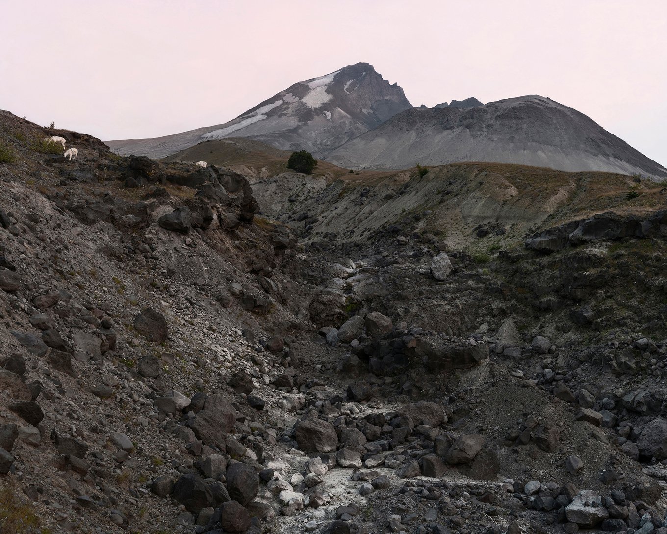
Buzzy Sullivan, Mountain goats grazing, Approximately one half mile north of the lava dome, 2017.
In 2016, I met the photographer Buzzy Sullivan at a bar in Phoenix, where we both live, to pore over Gohlke’s monograph on Mount St. Helens. As we turned the pages of the book, each plate elicited cries of renewed wonder and admiration, despite the fact that we had viewed the photographs dozens of times and even committed our favorites to heart. But there was something missing. Why wasn’t there a sequel to this work that explored the profound ecological change that had occurred in the intervening decades since the pictures were made, we wondered? By the time we had sipped our last beers, we had made plans to visit the volcano.
“When people asked why we planned to camp in the shadow of a volcano, I said we were seeking to document its life force.”
A year later we made our own journey to the mountain. It was August, and a heat wave was sweeping the Pacific Northwest. We trudged down the Pumice Plain in the full glare of the near-noon sun. I had the easy part. In addition to food and water, I was carrying only binoculars and a notebook. Buzzy hauled a tripod and a backpack filled with camera gear. Despite his load, the former champion skateboarder navigated the cobbles in the braided stream channels with the panache of a mountain goat. Twenty-five years his senior, I kept my eyes on the ground and slowly picked my way. The return to the car would be painful enough without a twisted ankle.
In the weeks leading up to our visit, people often asked why we planned to camp in the shadow of a volcano without a cell signal or running water. I always delivered my answer with a straight face: we were seeking to document its life force. May the force be with you, they laughed as they shook their heads.
In truth, scientists have been documenting the life force on Mount St. Helens ever since the volcano calmed down long enough to be safely reached by helicopter. In 1982, recognizing the unparalleled research opportunities in this post-eruption landscape, Congress designated a 110,000-acre national monument where “geologic forces and ecological succession [could] continue substantially unimpeded.” About a quarter of that land was set aside as a research zone, with further restrictions on public access.
Scientists from more than 70 universities, as well as museums and government agencies, flocked to the site, from spider taxonomists, herpetologists, and plant ecologists to mycologists and geologists. Mount St. Helens was within driving distance of two major American cities, which enabled long-term studies to be undertaken with relatively modest investments of time and money.

Buzzy Sullivan, Blowdown zone along Forest Service Road 99, Approximately six miles northeast of Mount St. Helens, 2017.
Outside the monument, it was business as usual. The forest service and private timber companies salvaged trees and aggressively replanted the land with rows of conifer seedlings. But in the heart of the blast zone, the trees were left where they fell, and scientists could simply observe and record, year by year, how nature responded to regime-altering change. Ecologists analyzed the chemistry and microbiology of soil and water samples, tracked temperatures, humidity, and nutrient levels, set up pitfall traps and nets, and established transects for documenting the coming and going of plant and animal species. In time, Mount St. Helens would become the most exhaustively studied volcano on earth. This great outdoor laboratory would allow scientists to test long-held assumptions about ecological responses to catastrophic disturbance. Their surprising results would upend fundamental theories about how nature works and change forest management in the Pacific Northwest and around the world.
“This great outdoor laboratory would allow scientists to test assumptions about ecological responses to catastrophic disturbance.”
Of all the places we had read about, Buzzy and I were most eager to visit the Pumice Plain, where the ground was so thoroughly cooked by glowing avalanches of rocks and searing gas that only microscopic organisms survived. It remains a challenging place. The pyroclastic flows left deep drifts of ash and pumice rocks. Volcanic ash is like a fine ground glass, and when lofted by the wind, it can turn into a sandblaster that abrades the protective cuticles of beetles and plant stems alike. Although the plain receives 140 inches of precipitation annually, it is droughty during the short summer growing season. To make matters worse, not only do the porous soils drain quickly, but their surfaces also heat up in the sun. At the height of summer, temperatures are fourteen degrees higher than in the shady forests on the edges of the blast zone.
Buzzy and I stood on this sun-shot plain, looking down on the shores of Spirit Lake. Where we once would have marveled at a tree canopy hundreds of feet above our heads, we now saw a meadow of wildflowers dotted with a wide scattering of small conifers. They were sparse and spindly, like Charlie Brown Christmas trees, and I could easily reach up and graze their crowns with my fingertips. The soil was gray and grainy, with the consistency of dry cornmeal. Remarkably, all around us a delicate shag of ground-hugging moss had colonized the friable pumice. Stitched into its brittle cushion were the flower stems of purple lupine, magenta fireweed, scarlet paintbrush, and white pearly everlasting. These bright flags of color nodded everywhere. As the wind raked across the plain, it stirred up the sweet scent of lupine. I closed my eyes. What would it have been like to stand in the old forest here, just hours before the volcano blew, to linger in the deep shade of the trees, with the sound of trickling water and the rusty-water-pump call of a varied thrush swallowed by the plush moss of a deep-time forest?

Buzzy Sullivan, Taking a rest near an alder thicket, Approximately three miles north of Mount St. Helens, 2017.
Remnants of the old-growth forest still littered the ground. As we approached Spirit Lake, we saw the silvered trunks of massive old-growth trees lying prone on the beaches and floating on the surface of the water. After debris from the eruption blocked Spirit Lake’s natural outflow through the north fork of the Toutle River, water levels rose so high that officials feared they would breach the new dam and flood downstream communities. In 1984, the U.S. Army Corps of Engineers dug a tunnel through a ridge on the north side of the lake to drain the excess water into Coldwater Creek. In the rise and fall of the lake over time, some of the trees in the floating log mat became dry-docked on shore. Those that were rafted back out into the lake left behind deep impressions in the sand. As I leaned over to examine one of them, a tiny, leprechaun-green Pacific treefrog skittled up the sides and disappeared into the damp shade under one of the toppled tree trunks.
“I dropped my backpack and waded fully clothed into Spirit Lake.”
I decided to take a cue from my froggy friend and find my own cool refuge. I dropped my backpack, stripped off my boots and socks and, with notebook in hand, waded fully clothed into Spirit Lake. I found a log to use as a backrest and proceeded to sink up to my waist in its cool waters. As I opened my notebook, the silver torpedo of a rainbow trout cruised by and then disappeared into waters as clear as aquarium glass.
I marveled at how changed Spirit Lake was from the early months after the eruption. Back then, hot springs bubbled in the lake, and its waters were black. In a Nova documentary, Charlie Crisafulli, an ecologist who came to Mount St. Helens in the early 1980s and still leads the long-term monitoring of the volcano for the forest service, described waters that were so opaque that if you had plunged your hand into them, you would not have been able to see your wriggling fingertips.
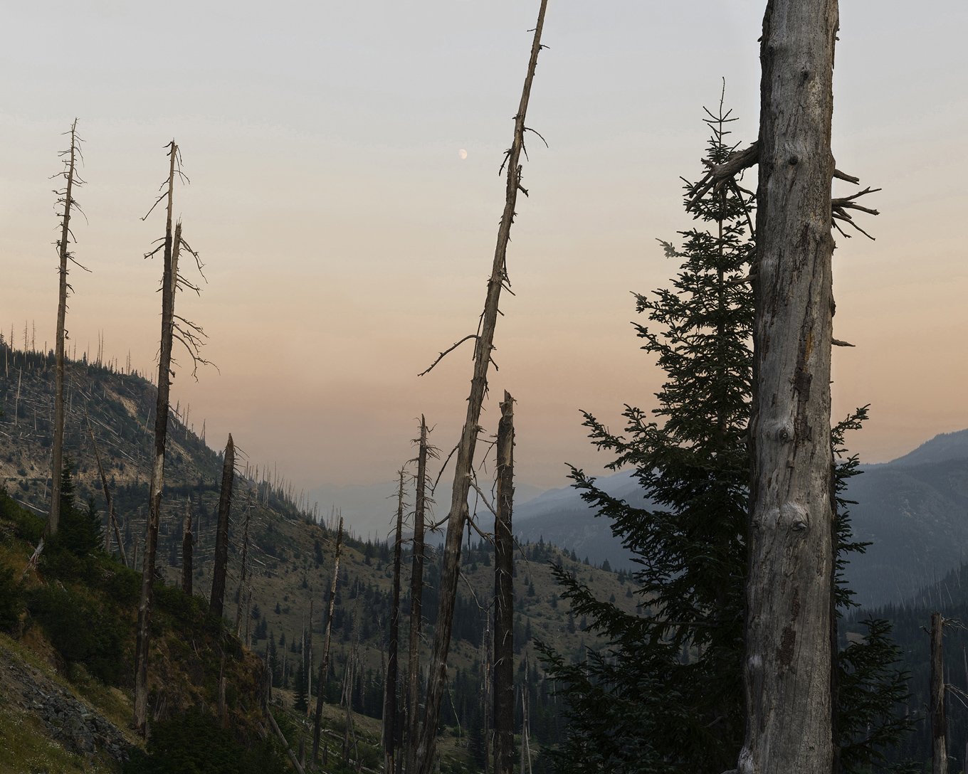
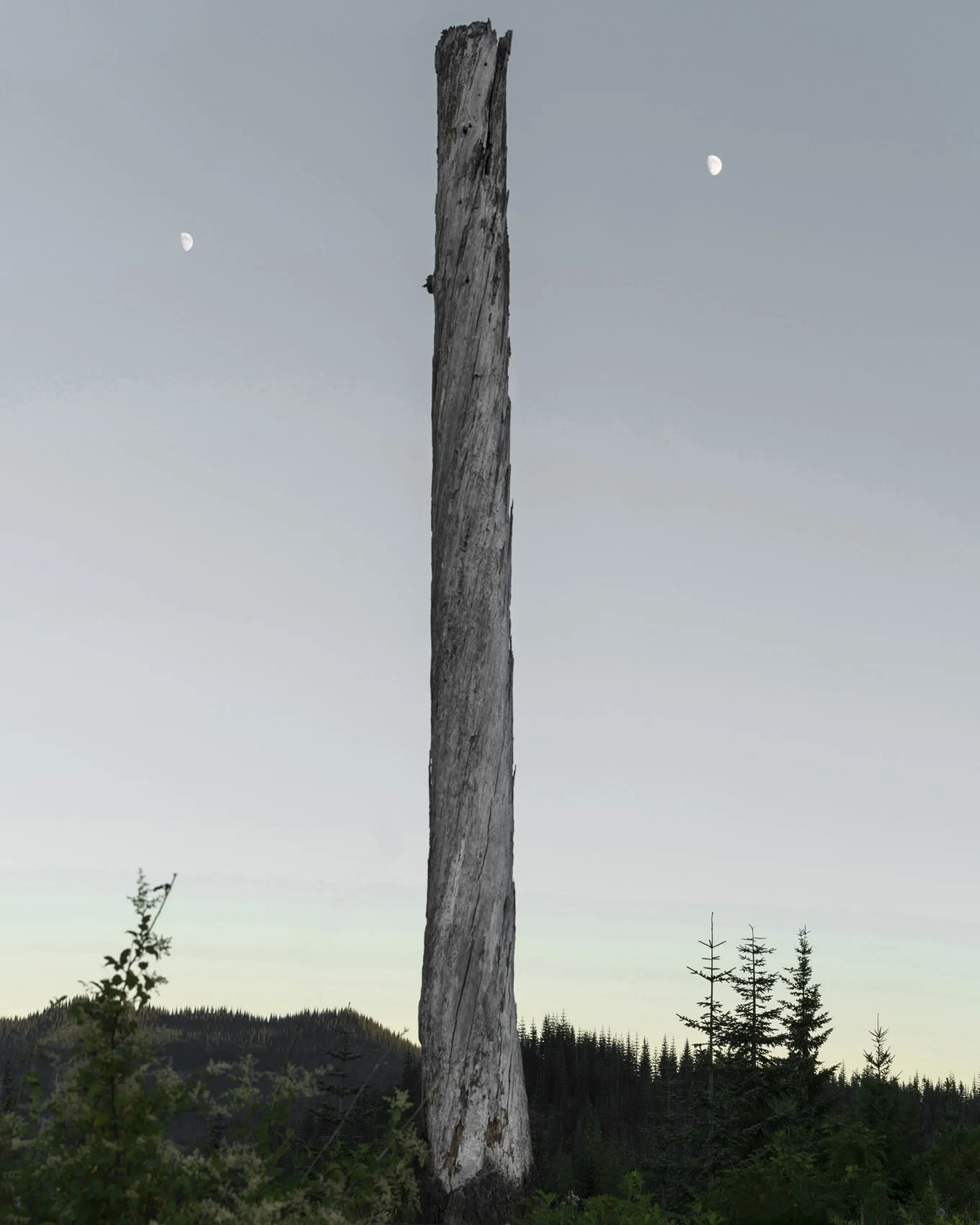
Buzzy Sullivan, Early evening moon near the entrance of the monument, Approximately fifteen miles northeast of Mount St. Helens, 2017.
In the immediate aftermath of the eruption, many scientists drew on lunar analogies to describe the scale and severity of the destruction. Jerry Franklin, then an ecologist with the forest service (now a professor at the University of Washington), was among the first to helicopter in. His team waited ten days before they were cleared to visit, and during that time, Franklin said, “We were actually hypothesizing that, oh, it’s a moonscape. It’s a sterile landscape. There’s nothing left.” But from the moment he landed and emerged from the whirlwind of ash kicked up by the helicopter’s blades, Franklin was shocked to discover that their suppositions “couldn’t have been further from the truth.” [18]
“Their findings revolutionized the field of disturbance ecology and changed the way foresters approach the management of altered systems.”
True, the Pumice Plain had been wiped clean. “Nothing organic survives in [temperatures approaching] 1,000 °C,” Franklin observed. But farther away, the picture was very different. The blast cloud left a thick dog-hair pattern of toppled trees across a 230-square-mile area, which became known as the blowdown forest. As the wind moved across the land, it gradually dropped its payload of stones and other debris, but retained its heat, and at the outer fringe of the blast zone the trees were seared but left standing. Scientists dubbed this the scorched forest. Then there was the debris-avalanche zone, northwest of the volcano, where the upper flanks of the mountain collapsed, burying the landscape in mud tangled with boulders, torn tree roots, and limbs.
Franklin’s team stopped first in the blowdown forest, where he was “immediately confronted by a whole bunch of plants that were coming up out of the ground. There were ants, and there were beetles, and there was evidence of pocket gophers. Right from the first, it was pretty evident that there was a lot of persistence of life and organic materials.” Many plants and animals had found protection underground or under deep snowbanks, rocks, or giant logs. His colleague Fred Swanson, a research geologist, was also startled by what he observed during their brief touchdown. He began digging holes in the ground and found “what looked like spider webs in the tephra,” which he later identified as mycelia, the pale, threadlike structures of fungi, which can form dense, underground networks. The mycelia had evolved to grow in response to forest fires, but in this case, Swanson observed, “heat from the eruption had triggered them.” [19] The surprises continued over the years. “We were constantly discovering ways in which organisms persisted that weren’t expected,” Franklin said. “Organisms survived! I always loved it when the reality of nature just totally slapped us around and blindsided us. It was just so much fun to see how all of these different organisms persisted and got back to work.” [20]

Buzzy Sullivan, Standing dead on the boundary of the blowdown zone, Approximately ten miles northeast of Mount St. Helens, 2017.
Their findings revolutionized the field of disturbance ecology and changed the way foresters approach the management of altered systems. They formed the basis for a set of provocative new management protocols known as New Forestry. Developed by Franklin, New Forestry challenged conventional practices in the Pacific Northwest, where loggers routinely removed valuable timber from a site and then cleared it of materials such as rotting or diseased trees, branches, and tree roots, before thickly replanting the tract with conifer seedlings. Often the land was doused with herbicides to keep sun-loving grasses and shrubs from competing with the new tree crop. But after observing the response of plants and animals to radical change at Mount St. Helens, Franklin concluded that nature does disturbance differently.
“New Forestry seeks to emulate nature’s disturbance patterns, which are biologically and structurally diverse, improvisational, and patchy.”
A catastrophic event which, at least from the air, seemed so monolithic in its destructive effects had left behind a landscape that was biologically and structurally diverse, improvisational, and patchy. The scientists identified the location and timing of the disturbance as critical factors that determined the makeup of this mosaic. Organisms on north-facing slopes with their backs to the volcano, for example, found a greater measure of protection than those on south-facing slopes that were exposed to the direct impact of the blast. And nocturnal species that were tucked into underground burrows, such as the northern pocket gopher, survived to play an outsize role in the new ecosystem. By mixing deep layers of rich soil with the surface layers of ash, the gophers helped create islands of fertility for colonizing plants, and they dug moist, protective tunnels that salamanders could use to safely traverse the otherwise-blasted terrain.
The time of year also influenced how the landscape responded to the volcano’s disruption. When Mount St. Helens blew in mid-May, patchy drifts of snow and ice still lingered in some areas, buffering them from the worst effects. Today, in places like Ghost Lake, the giant silvered trunks of scorched Douglas fir preside over a young forest of noble fir, huckleberry, snowbrush, and bracken fern. As seeds and young plants, they were protected under deep, insulating blankets of snow or by the shelter of steep ridges when the volcano erupted. The behemoth trees are as valuable now in death as they were in life. Birds use their perches for hunting or territorial singing, as on-the-fly pantries for insects, or as cozy nest cavities. When their magnificent trunks crash to the forest floor, they become nurse logs for mosses, fungi, and tree seedlings, and homes for a whole new suite of animals, such as spiders, beetles. and salamanders.
Franklin’s key insight was that nature rarely wipes the slate clean. The messiness that remains, like the scrim of trees in Gohlke’s Coldwater Creek photos, can be just as important as what’s taken away. “The way we imagined natural systems responding to disturbance events isn’t the way they really do at all,” Franklin said. “There is this continuity of life between the predisturbance ecosystem and the postdisturbance ecosystem, in terms of structure, biota, function.” Instead of “terminating a forest” before replanting it, New Forestry seeks to emulate nature’s disturbance patterns by saving a certain percentage of downed logs and woody debris on the forest floor, standing dead snags for birds’ nests and insect cavities, and live trees as seed sources. Franklin calls these features legacy effects. [21]

Buzzy Sullivan, Sun illuminating the forest near Bear Meadows, Approximately sixteen miles northeast of Mount St. Helens, 2017.
Today, at age 80, Franklin continues to apply his experiences on Mount St. Helens in the crafting of leading-edge forest-management policy. In the 1990s, he built a national reputation for saving old-growth forests on public lands and helped draft protections that became the foundation for the Clinton administration’s 1994 Northwest Forest Plan. At the same time, however, he began to see that young treeless ecosystems, known as early seral habitats, were also rare and needed protection. Those scrubby, undramatic places dominated by shrubs, grasses, and forbs once constituted twenty percent of forests near the Oregon coast. By the 1990s, that number had dwindled to two percent. At Mount St. Helens, however, early seral habitat was abundant, and it produced a big bump in biodiversity. For example, researchers compared the landscapes left to develop naturally within the monument’s study zone with those that were thickly planted with conifer seedlings, just outside the boundary. Both the number and variety of bird species were significantly higher in the shrubby habitat of the study zone. Likewise, butterflies, bees, and other bugs found forage among the wildflowers that bloomed in places liberated from a shady canopy of trees, and sun-loving shrubs bearing huckleberries and wild blackberries attracted bears and other critters. [22]
This biological richness caused Franklin to question his assumptions that tree cover was the most desirable condition for the land. “I would be wandering around on Mt. St. Helens, thinking, well, I wonder when this landscape is going to recover?” he recalled. “Then, I thought, wait a minute, what does that mean? When is it going to be back to evergreen conifer forests again? Wait a minute, why do I want that to happen real fast? Why do I want to abridge what’s happening right now and get it back to that state, because look at this, this is so rich and so beautiful and so diverse.”
He continued:
And so my second epiphany was, wow, the early seral ecosystem, this period in which trees are not the dominant plant life is really, really important. … We need to be sure that we’re managing, at least in our public forests, to have this kind of condition. And guess what? We aren’t doing that. I’ve become a strong advocate of actually doing some management, in part, to create those kinds of systems. Not cutting old growth, but cutting previously harvested forest areas. We don’t provide for that kind of habitat. … The only place you get it is where nature blows a hole for you. And that’s probably not enough of it, and it’s probably not well enough distributed. So what that has done for me is remind me what I knew intuitively all along, which is: if you care about these systems, you have to care about the entire development sequence. You have to be as concerned about the early seral as you are about the old growth. [23]
Today, Franklin and many of his colleagues are vocal champions of early seral habitats. To increase biodiversity in Pacific Northwest forests, they have recommended controversial logging prescriptions aimed at opening up biologically simple forests, currently dense with Douglas fir, to accommodate a greater number of young, treeless habitats. [24] The debate they’ve started is far from resolved. Nonetheless, it highlights an irony that is tremendous and beautiful in its implications. The disruptive force of the volcanic eruption did not create a moonscape, as so many people had feared. Instead, it laid bare the irrepressible force that drives life blood through the chambers of nature’s heart. It opened up new ways of thinking about how to make that beat stronger, noisier, more insistent, more lifesome.
Buzzy Sullivan, Standing Dead over two exposures, Approximately eleven miles northeast of Mount St. Helens, 2017.
In June 1982, Charlie Crisafulli boarded a helicopter bound for the Pumice Plain, for what seemed like the umpteenth time. A full two years had passed since the volcano’s eruption, and he had been flying transect after transect over the rubble in search of any sign of life. “It was complete and utter barrenness,” he recalled. [25]
Then he saw something that made him move to the edge of his seat: a single prairie lupine plant. He couldn’t believe his eyes. He signaled the pilot to land and ran over to the plant, and, sure enough, arcing from the lupine’s starburst of leaves were sprays of showy periwinkle-purple blossoms with creamy white throats upturned toward the sun. Prairie lupines once grew mainly above the treeline, where they had unfettered access to the sun’s rays. The eruption had cleared the plain of competing trees and shrubs, creating thousands of acres of open habitat for lupine. Crisafulli speculates that a seed had somehow survived the blast and been washed off the mountaintop.
“Then he saw something that made him move to the edge of his seat: a single prairie lupine plant. Within a decade, there were 169,000.”
Though the seed germinated in a place free of competitors, conditions were far from ideal. For starters, newly erupted volcanic sediments are poor in essential nutrients. Samples taken on the Pumice Plain just after the eruption measured zero for organic carbon and nitrogen, both of which are critical for plant growth. But lupines have a chemical advantage: they come equipped with their own fertilizer factory. They form a cooperative relationship with bacteria on their roots that can capture nitrogen in the air and fix it into a form the plant can use. In exchange, the plant provides the bacteria with sugars from photosynthesis.
Crisafulli marked the location of the volunteer lupine and added it to the forest service’s rounds of annual monitoring. Within a decade, the tally showed that the lupine population had jumped from one to 169,000 plants. Today, lupines cover the Pumice Plain and, in some years, form great tongues stained with brilliant color that lick their way up the volcano’s slopes. As they proliferate, these hardy pioneers have helped to ameliorate the harsh environment so that other plants and animals can get established on the plain. Leafy mounds of lupines trap and stabilize blowing sediments. When individual plants die and decompose, they add precious nitrogen to these stores. And lupines provide a nutritious food staple for the northern pocket gophers, whose activities hoist buried layers of nutrient-rich soils to the surface. Over time, gopher mounds create hospitable conditions that allow whole new suites of plants and animals to gain a toehold on the ravaged plain.

Buzzy Sullivan, Throwing rocks above Bean Creek, Approximately twelve miles east of Mount St. Helens, 2017.
Crisafulli’s colleague Tara Blackman, a volcano ecology researcher, has noted a similar pattern of stasis and change on the mountain. Part of her job is an managing field operations for the annual monitoring. She supervises a crew of technicians who sample study sites all over the mountain. “I like to say that my job is to notice things that are different from year to year,” she said. “You develop intimate relationships with these landscapes, and that’s really important because you have to have that intimate knowledge to be able to observe change. Each field season is kind of a surprise. What am I going to see that’s totally unexpected? Or is everything going to be the same?” [26]
“‘Each field season is kind of a surprise,’ Blackman said. ‘What am I going to see that’s totally unexpected?”
From time to time, there are big surprises. Case in point. During nearly a decade of field work on the mountain, Blackman skipped a year while working on a graduate degree in fisheries science. When she returned the following summer, she lost her way on the familiar route to the crew’s boat launch. “I was walking down to Spirit Lake, and I got lost in this thicket of alder shrubs,” she said. Alders, too, host nitrogen-fixing bacteria on their roots, which helps them flourish in nutrient-poor environments. “It became very apparent to me, once I started looking around, that these shrubs had advanced onto the Pumice Plain, ten, twenty meters. And then the next year another twenty, thirty meters. Areas that were completely barren were now completely covered in shrubs ten feet tall. We started calling it the march of the shrubs. Now we have to cut trails through places that I used to just be able to see and walk to.”
More recently, there has been an explosion of conifers. A few years ago, Blackman walked out to the research plots on the plain on the first day of the field season and stopped short. “Something just looked different to me,” she recalled. “I realized that there were all these baby conifers everywhere.” Researchers have tagged the new conifers in the study plots so that they can document their growth rates and survival. If they manage to hang on and grow up, Blackman said, “it’s going to change things immensely. It’s a pivotal question. Those conifers will create the closed-story forest canopy in the future.” [27]

Buzzy Sullivan, Alder thicket on the pumice plain, Approximately one mile north of Mount St. Helens, 2017.
The landscape has already yielded tremendous insight, but the mountain is still in the early stages of its ecological response. Scientists would like to watch that process unfold, but the forest service faces constant pressure to open up the restricted areas to people who want to camp in the shadow of the volcano, fish in Spirit Lake, or aggressively replant the early seral habitat with conifer seedlings. In the early days of the Obama administration, The New York Times reported on the “Clash over [the] Rebirth of Mt. Helens,” and interviewed locals who wanted to end public restrictions in the monument. “You don’t need 20,000 acres to see how vegetation comes back,” said one critic. “Throw out the study and let people recreate,” said another. [28]
“It’s really powerful to know not only was this landscape destroyed but it will be destroyed again.”
Opportunities for hunting, fishing, camping, and logging abound throughout the Pacific Northwest. The experience that Mount St. Helens provides, however, is unique. As Gohlke observed, it possesses “a kind of magnificence that you would have a hard time finding anywhere else.” Much of that magnificence can be traced to the scientific discoveries that have been made there. Major volcanic eruptions are uncommon, but rarer still when they take place in an area where scientists have the access, commitment, and capacity to carry out long-term studies that probe the question, What happens after the worst happens? “It’s one thing to know that your landscape was formed by a volcano millions of years ago,” Blackman said, “but it’s another thing to see the place, the before-and-after pictures.” We watched the mountain blown to ash and then, thanks to the scientists, we watched the miracle, as Blackman put it, of “life trying to figure it out again.” And we’ve used those insights to manage our own human-made disturbances with greater wisdom for the long-term health of the land. [29]
Perhaps we can use these same insights to manage the long-term health of our psyches as well. The volcano allows us to bear witness to the oscillating rhythm of our lives: the terrifying wrecking ball of annihilation, on the one hand, and the endless inventiveness of life on the other. Here, we can sit on the shores of Spirit Lake with our backs up against a tree that grew to be 1,000 years old before it was knocked down by the blast while looking out over a dense carpet of purple blooms that started from a single surviving seed. “It’s really powerful to know not only was this landscape destroyed but it will be destroyed again,” Blackman says. “It just feels so much bigger than us, so much more powerful than anything man can control or try to even control. It definitely puts us in our place.”
Notes
Frank Gohlke, “Thoughts on Landscape,” Landscape Journal, Vol. 14, No. 1 (Spring 1995), 1-9.
Frank Gohlke, interview with author, June 2017.
Peter Galassi, Frank Gohlke, Simon LeVay, and Kerry Sieh, Mount St. Helens: Photographs by Frank Gohlke (New York: The Museum of Modern Art, 2005), 80.
Gohlke interview.
Ibid.
Ibid.
Qtd. in Vince Sticherz, “Experts list: Lessons from Mount St. Helens being applied today,” press release, University of Washington, May 3, 2010.
Morton D. Paley, The Apocalyptic Sublime (New Haven and London: Yale University Press, 1986).
David Maisel, Black Maps: American Landscape and the Apocalyptic Sublime (Göttingen: Steidl, 2013).
Galassi, et al., 85.
Ken Johnson, “Quiet and Formal Photographs of a Natural and Violent Devastation,” The New York Times, August 5, 2005.
Charles Goodrich, Kathleen Dean Moore, and Frederick J. Swanson, In the Blast Zone: Catastrophe and Renewal on Mount St. Helens (Corvallis: Oregon State University Press, 2008), ix.
Gohlke interview.
Walker Percy, The Message in the Bottle: How Queer Man Is, How Queer Language Is, and What One Has to Do with the Other (New York: Picador, 2000).
Walker Percy, Lost in the Cosmos: The Last Self-Help Book (New York: Farrar Straus Giroux, 1983).
Walter Isaacson, “Walker Percy’s Theory of Hurricanes,” The New York Times, August 4, 2015.
Gohlke interview.
Jerry Franklin, interview with the author, January 2013.
Pacific Northwest Research Station, U.S. Department of Agriculture, “Mount St. Helens 30 Years Later: A Landscape Reconfigured,” Spring 2010. [PDF]
Franklin interview.
Ibid.
Mark E. Swanson, Jerry F. Franklin, Robert L. Beschta, Charles M. Crisafulli, Dominick A. DellaSala, Richard L. Hutto, and David B. Lindenmayer, “The forgotten stage of forest succession: Early-successional ecosystems on forest sites,” Frontiers in Ecology and the Environment, Vol. 9, No. 2 (March 2011), 117-125. http://doi.org/bkwgtk.
Franklin interview.
Warren Cornwall, “Why Does This Famous Protector of Trees Now Want to Cut Some Down?,” Science, October 5, 2017, http://doi.org/cmbb.
Mount St. Helens: Back from the Dead, documentary program, NOVA (PBS), Season 37, Episode 10, aired May 4, 2010.
Tara Blackman, interview with author, September 2016.
Ibid.
Cornelia Dean, “Clash Over Rebirth of Mt. St. Helens,” The New York Times, August 17, 2009.
Blackman interview.